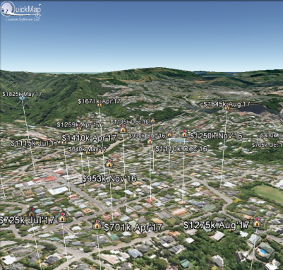
Salesview allows you to filter sales based on a comprehensive query engine, then overlay the sales in Google Earth to give you a more visual way to illustrate sale price in any given area. The sales can be filtered by clicking the sales button. After your sales are selected, click the report button, and Google Earth will appear as one of the report options.
With Sales data, the higher the icon, the more expensive the property. This view is particularly useful for spotting anomalies.
Google Earth allows you to email this map, so you can easily send it to a Client, Colleague or Friend.
Of course you will need to download and install Google Earth first. Google, Inc. provides three product levels to Google Earth, which you should investigate before using Google Earth with Quickmap. For the most timely and complete Google Earth licensing options, please consult Google’s website and license agreement at http://earth.google.com/downloads.html.
Pasting photos into Quickmap from Google is also easy. Just select Copy Image off the Edit menu in Google, and press CTRL/V in Quickmap. The image will be automatically positioned in the right place for you (georeferenced).


Alternatively, you can transpose a Quickmap image to Google Earth by following these instructions: