Overview
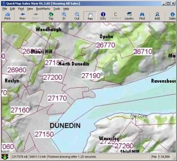
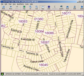
The Valuation Roll Boundary Map replicates the Valuation roll maps that were maintained by the now defunct Valuation Department.
The Valuation Roll Boundary Map Expansion pack is included with QuickMap Enterprise and SalesView.
Valuation Roll Boundary Map
The roll maps were created by determining the most prominate rolls within each meshblock then merging the meshblocks into the roll coverage. In Auckland City the aggregation was done at the survey parcel level due to the fact that Auckland City Council created their own roll numbering system based on a combination of street name and area. The result of the merging of the meshblocks (or in the case of Auckland City Council the survey parcels) is a set of boundaries that closely resemble the valuation roll maps. We have termed this an estimated roll boundary because at the edge of each roll boundary there may be a few properties that are contained with the neighbouring roll boundary or contained within multiple roll boundaries. However in most cases the roll boundaries are a good estimate of the original Valuation Department roll boundary definitions.Why Use the Valuation Roll Map?
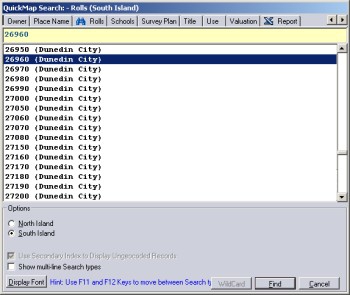
If you have a valuation reference but can’t find a property then search on the roll number and instantly zoom to the region that the roll number applies to. You can then pan around the map to find the property.Use the roll boundary to validate a roll number.Installing
Installing the Valuation Roll Boundary Map Pack requires that you have already purchased and installed QuickMap Enterprise.
Upgrading and Licensing
The Valuation Roll Boundary Map Pack is licensed per PC. Pre-existing QuickMap users can purchase and install the Expansion Pack without having to repurchase or upgrade to the latest version of the software.
Customised Maps
Other QuickMap data layers can be drawn underneath the valuation roll areas to highlight specific features. In addition you can also add your own data to create a customised maps. For example, sales territories or school zones.


