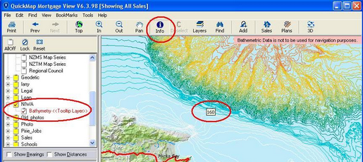
The Bathymetry Expansion pack shows seabed contours.
Please Note that this Data is not to be used for navigation purposes.
Right-mouse click on the layer and selecting ToolTip Layer so that when the Info Tool hovers over a contour, it will indicate the depth.