QuickMap will then plot your current position on the map and save a breadcrumb trail as you move around. All data downloaded from the GPS unit into QuickMap is saved into the Edit Layer under the Custom tab.
If you choose the Download Waypoints button then the waypoints will also be saved into the Edit Layer under the Custom tab.
If your GPS does not support NMEA protocol, or cannot download waypoints using NMEA then you can still download the data from your GPS unit by Importing a waypoint file.
To download waypoints from a waypoint file:
| • | Download GPS TrackMaker from www.gpstm.com (this software will support almost every GPS unit interface) and install. |
| • | Run the GPS TrackMaker software: |
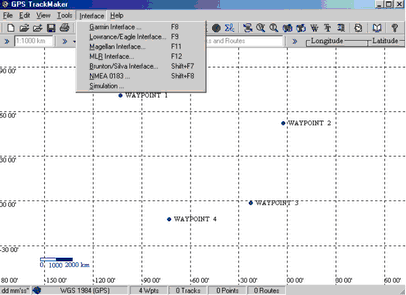
Select the Interface menu and then select the appropriate interface (depending on your type of GPS unit) Eg. Garmin Interface:
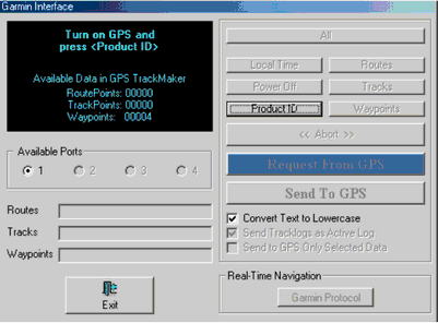
| • | Then select the Request from GPS button |
| • | This will import your waypoints into TrackMaker |
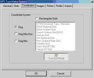
| • | Then select the Tools>Options menu and this will display the GPS TrackMaker Options dialog. In this dialog, click on the Coordinates Tab, then click on the Deg radio button to set it to degrees. |
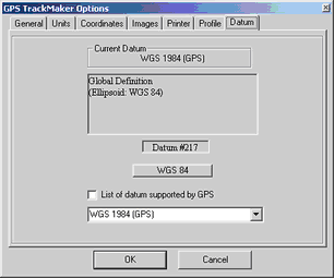
Click on the Datum Tab and ensure WGS 84 is selected as below.
Next select the File>Save File and save your GPS data as a waypoint file:
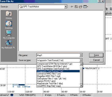
Note: The File Type MUST be Waypoint+ TextFormat (*.txt)
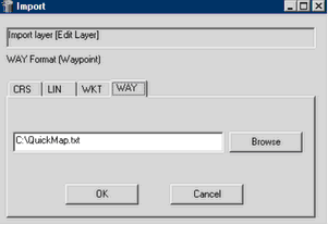
From QuickMap select File>import and you will be presented with the following import box that will enable you to browse to your waypoint file and then import it.
All waypoints are saved into the Edit Layer under the Custom tab.