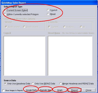
Click the Sales button then the Reports Button to access Google to overlay the sales reported on the map.
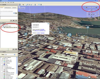
From Google Earth, use the horizontal slider at the top of the map to tip the view over to a panoramic view as shown. The height of each house in this view is determined by the sale price.
If the property boundaries do not overlay the photo boundaries in Google Earth accurately, it is possible to shift the boundaries using Google Earth’s edit tool.
NOTE: It is important not to save the QuickMap Files in the Temporary Folders. To Save a file