|
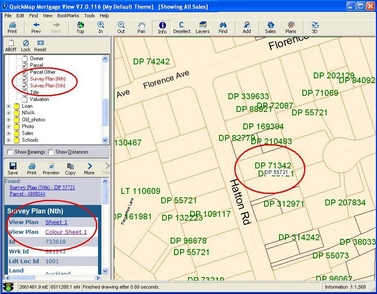
To view the Survey Plans in an area:
| 1. | Turn on the Survey Plan layer |
| 2. | Use the ‘Info’ tool to select the plan you are interested in |
| 3. | Click the View Plan hyperlink to view the plan you are interested in.
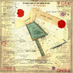
The Survey Plan will be viewed using whichever application your PC is registered to open JPEG or TIF images. |
To view a specific plan where the Land District and Plan number is known:
| 1. | Click on the ‘Plans’ button on the Toolbar |
| 2. | Select the appropriate Land District |
| 3. | Enter the plan number. Do not include the plan type. You can use ‘*’ as a wild card |
| 4. | Click the search button. |
| 5. | Select the plan that you want to see from the listed set of plans |
| 6. | Click the View button to view the plan you are interested in. |
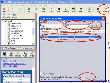
| 7. | The Survey Plan will be viewed using whichever application your PC is registered to open JPEG or TIF images. |
|