Skip to content
Quickmap

Quickmap

Taking The Guesswork Out Of Property Information

Primary menu

  • Quickmap
  • News
  • Products and Services
    • Quickmap Enterprise
    • Expansion Packs
      • Quickmap Salesview
      • QuickMap Surveyview
      • FREE Survey Plans
      • Aerial Imagery
      • Topo50 raster maps
      • Bulk Data
      • Free Downloads
    • Downloads
  • Integration
  • Pricing
  • Support
    • Remote Support
  • Contact Quickmap
Menu
  • Quickmap
  • News
  • Products and Services
    • Quickmap Enterprise
    • Expansion Packs
      • Quickmap Salesview
      • QuickMap Surveyview
      • FREE Survey Plans
      • Aerial Imagery
      • Topo50 raster maps
      • Bulk Data
      • Free Downloads
    • Downloads
  • Integration
  • Pricing
  • Support
    • Remote Support
  • Contact Quickmap

Tag Archives: Exporting

Unable To Export Height (Z) To DXF

Posted on February 20, 2023 by Webmaster

If you can’t export the height of a layer to a DXF file, it’s probably because you’ve got the wrong Column label set. To export the height of a layer, make the layer the active layer then click on the Continue reading Unable To Export Height (Z) To DXF→

Posted in Knowledge Base | Tagged DXF Files, Export Height (Z), Exporting

How To Copy Data From One Layer Into Another

Posted on October 3, 2018 by Webmaster

Sometimes you might want to copy data from one layer and insert it into another layer. An example of this might be if you have a “Jobs” layer that’s stored in your “Edit” layer – you might want to store Continue reading How To Copy Data From One Layer Into Another→

Posted in Knowledge Base | Tagged Exporting, Importing, Layers

How To Backup A Layer In Quickmap

Posted on October 3, 2018 by Webmaster

There are a couple of options to backup a layer in Quickmap. The best way to backup a layer is to right click the layer you want to backup, then click Layer Properties, you can then find out the database Continue reading How To Backup A Layer In Quickmap→

Posted in Knowledge Base | Tagged Backup & Restore, Exporting

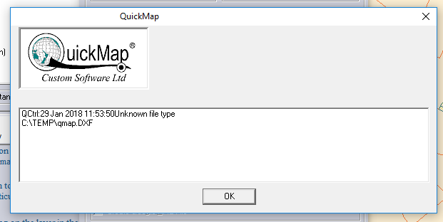
“Unknown File Type” Error When Exporting DXF

Posted on January 29, 2018 by Judy

When exporting to DXF in Quickmap you can get this error: QCtrl: Unknown file type C:\TEMP\qmap.dxf The Unknown file type error can be caused by a permission problem when exporting. Try changing the path to fix this. Please like this page:

Posted in Knowledge Base | Tagged DXF Files, Exporting, Unknown File Type

How To Import Quickmap Data Into CAD Software / GIS Programs

Posted on May 3, 2017 by Webmaster

To import Quickmap data into CAD packages such as AutoCAD or other GIS programs such as ArcInfo, you must export data in DXF Format which can be read by most GIS and CAD software. For more information on importing / Continue reading How To Import Quickmap Data Into CAD Software / GIS Programs→

Posted in Knowledge Base | Tagged ArcInfo, AutoCAD, Exporting, Importing

How To Save Maps As An Image

Posted on May 3, 2017 by Webmaster

Maps can be saved digitally as a .tif, .jpg and other image formats which can be cut and pasted into other programs or documents, such as Microsoft Word. To save a map as an image file in Quickmap, click Edit Continue reading How To Save Maps As An Image→

Posted in Knowledge Base | Tagged Exporting

Quickmap Exports The Wrong Data

Posted on May 3, 2017 by Webmaster

When exporting data from Quickmap, more data gets exported than what is shown on the screen and not the data I wanted. For example, when exporting a small area shown on the screen (2000m2) to DXF, the whole of the East Continue reading Quickmap Exports The Wrong Data→

Posted in Knowledge Base | Tagged Exporting, Layers

How To Export Observations Between Two Marks

Posted on May 3, 2017 by Webmaster

If you want to export observations between two marks that are 32km apart from Landonline to load into 12D, you can’t because of size limitations within Landonline. This is because the LandXML export is just too big for Landonline. you can get around Continue reading How To Export Observations Between Two Marks→

Posted in Knowledge Base | Tagged Exporting, LandOnline, Marks, Observations

How To Report Owner Information From Quickmap

Posted on May 3, 2017 by Webmaster

Owner Information can be exported in Quickmap by selecting CTRL/R and selecting the Appellation Layer. The Appellation layer contains title / owner details associated with the Primary LINZ LINZ Parcel. LINZ define the primary parcel layer as the layer of Continue reading How To Report Owner Information From Quickmap→

Posted in Knowledge Base | Tagged Appellation Layer, Exporting, Owner Data

Primary Sidebar Widget Area

Contact Quickmap

Contact Quickmap
to arrange a demo

0800 145 554
support@quickmap.co.nz

Quickmap Overview
  • Quickmap Enterprise
Quickmap Expansion packs
  • Salesview
  • Surveyview
  • Survey Plans
  • Aerial Imagery
Other Products
PropertySmarts PropertySmarts is an online property information system written exclusively for members of the Real Estate Institute of New Zealand.
Prover Prover is an online property information system that provides access to national coverage of titles, sales, aerial imagery and council data.
Premise Premise is an online map-centric cadastral information system.  It has been built from the ground-up under consultation with industry professionals and offers features and data that no other tools in NZ provide.

Footer menu

  • About Us
  • Quickmap Support
  • Website Terms and Conditions of Use
  • Quickmap Terms and Conditions
  • Offline Registration
Footer Menu
  • About Us
  • Quickmap Support
  • Website Terms and Conditions of Use
  • Quickmap Terms and Conditions
  • Offline Registration
Go to Header Section
Facebook
Twitter
LinkedIn