Zoom In ![]()
Zoom In will magnify the map by the amount dragged out with the mouse in the map window. When zoom in is selected, the map enters a zoom in state indicated by the zoom in cursor.
To Zoom in, click the Zoom In button, then hold down the left mouse button on the map and drag out a rectangle.
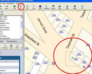
You can also zoom in by pressing the + key or Page Up key.
Zoom Out ![]()
Zoom Out will reduce the map to a smaller scale, enabling you to see a larger area. When Zoom Out is selected, the map enters into a zoom out state, indicated by the Zoom Out cursor. Just click on the map and it will set the scale to be twice the current size. To set your map to a particular scale, select Set Scale (Control/S)
You can also zoom out by pressing the – key or Page Down key.
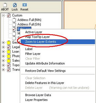
Zoom to Layer Extents
It is also possible to zoom the map into the smallest rectangle that encompasses all of the information contained in a particular layer by right-mouse clicking on the layer in the Layer Control window, and selecting Zoom to layer extents For more information on this subject view Layer Controls.
Zoom to Selection
This will zoom the map into the smallest rectangle that encompasses all of the information currently selected.
(View Menu or F4)