Combinations of layers are further grouped into Layer groups. The images below show Layer Groups Custom, Geodetic, Legal, Topo and Transport.
A layer can be likened to a transparent sheet with part of a map drawn on it, and the map displays all the layers that are visible.
If the Layer Control Window is not visible, click on the Layers Button on the Toolbar. For the Layer Window to remain in place, look at Docking Windows.
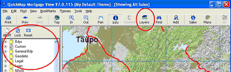
To view the layers under any given Layer Group click on the plus symbol next to the group.
In the example below, clicking on the plus sign next to the Custom Group displays layers in that group, including Edit Layer.
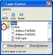
Buttons can be used to turn all Layers Off, to Lock Layers and Reset them.
For more information on Layers, look at: