LandOnLine Survey Plan data at your fingertips!
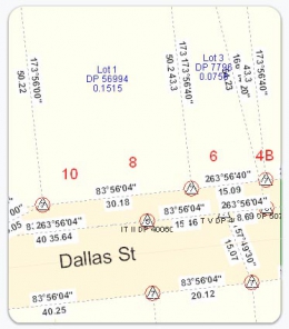
Surveyview provides you access to the Landonline Survey Plan data. This expansion pack is an essential data set used by most surveyors, and also used by builders who need to know how accurate the boundaries are in Quickmap.
Quickmap Surveyview is the only source for this data outside Landonline and gives you fast access to details on around 60 million observations and 11 million marks throughout New Zealand.
The data is updated monthly, and provides survey information for every parcel in New Zealand, which makes a perfect compliment to the Pre-LandOnLine Survey Plans Expansion pack.
Layers provided with Surveyview include:
- Mark (All)
- Mark Name
- Mark NZGD1949 Order 1-3
- Mark NZGD1949 Order 4-9
- Mark NZGD2000 Order 0-3
- Mark NZGD2000 Order 4-5
- Mark NZGD2000 Order 6
- Mark NZGD2000 Order 7-10
- Mark SDC
- Mark Vertical 1-2
- Mark Vertical 3
- Mark Vertical 4-6
- Vector (All)
- Vector Cadastral
- Vector Dimensions
- Vector Geodetic
Observations
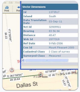
Surveyview gives you quick easy access to around 60 million observations throughout New Zealand.
Observation information incudes:
- Bearing
- Distance
- Coordinate System
- Class of Survey
- Surveyed Class
- Arc details
- Equipment used for the observation
Marks
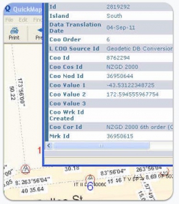
Information provided in over 11 million marks will tell you exactly how reliable they are.
Mark information provided with SurveyView includes:
- Mark Source
- Coordinate System
- Authorative Coordinates
- SDC Status
- Mark Status
- Mark Type
- Mark Name
Perhaps the most important information associated with the mark is its Survey Accurate Digital Cadastre Status (SDC). Surveyview provides an SDC layer which will circle the mark in red if it has achieved SDC status. Where the survey data meets the accuracy standards required in the Survey Regulations, the marks are assigned SDC status by Land Information New Zealand (LINZ).


