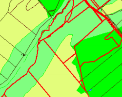
Land Use Classifications (based on the New Zealand Land Resource Inventory [NZLRI]), are available as a free downloadable dataset via the Quickmap Tools -> Downloads menu. The Land Use Classifications come with surveys carried out from the early 1970s to the mid 1990s and include arable use such as soil physical or chemical properties, erosion and other land use classifications. Layers Land Use Parcels and Land Use Labels are added to the Land Use group in Quickmap. This data was published in August 2017.

Please like this page:
